Wuhan Shilong Technology Showcases at Hangzhou Flood and Typhoon Emergency Drill, Empowering a New Paradigm for Urban Safety with Technology
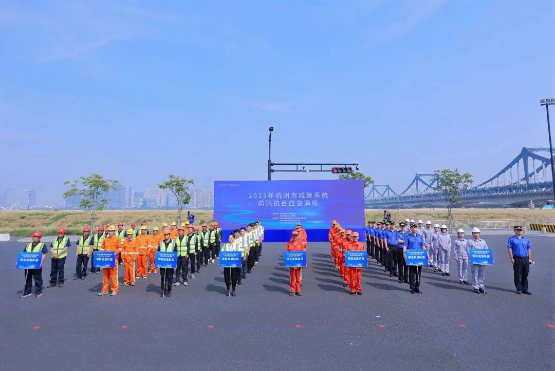
On 2025/5/26, the Hangzhou Urban Management System conducted a flood control and typhoon emergency drill in Xiaoshan District. Wuhan Shilong Technology showcased its SL-VGPR vehicle-mounted 3D Ground Penetrating Radar and SL-MGPR multi-frequency 3D GPR, providing critical technical support for monitoring urban underground space safety.
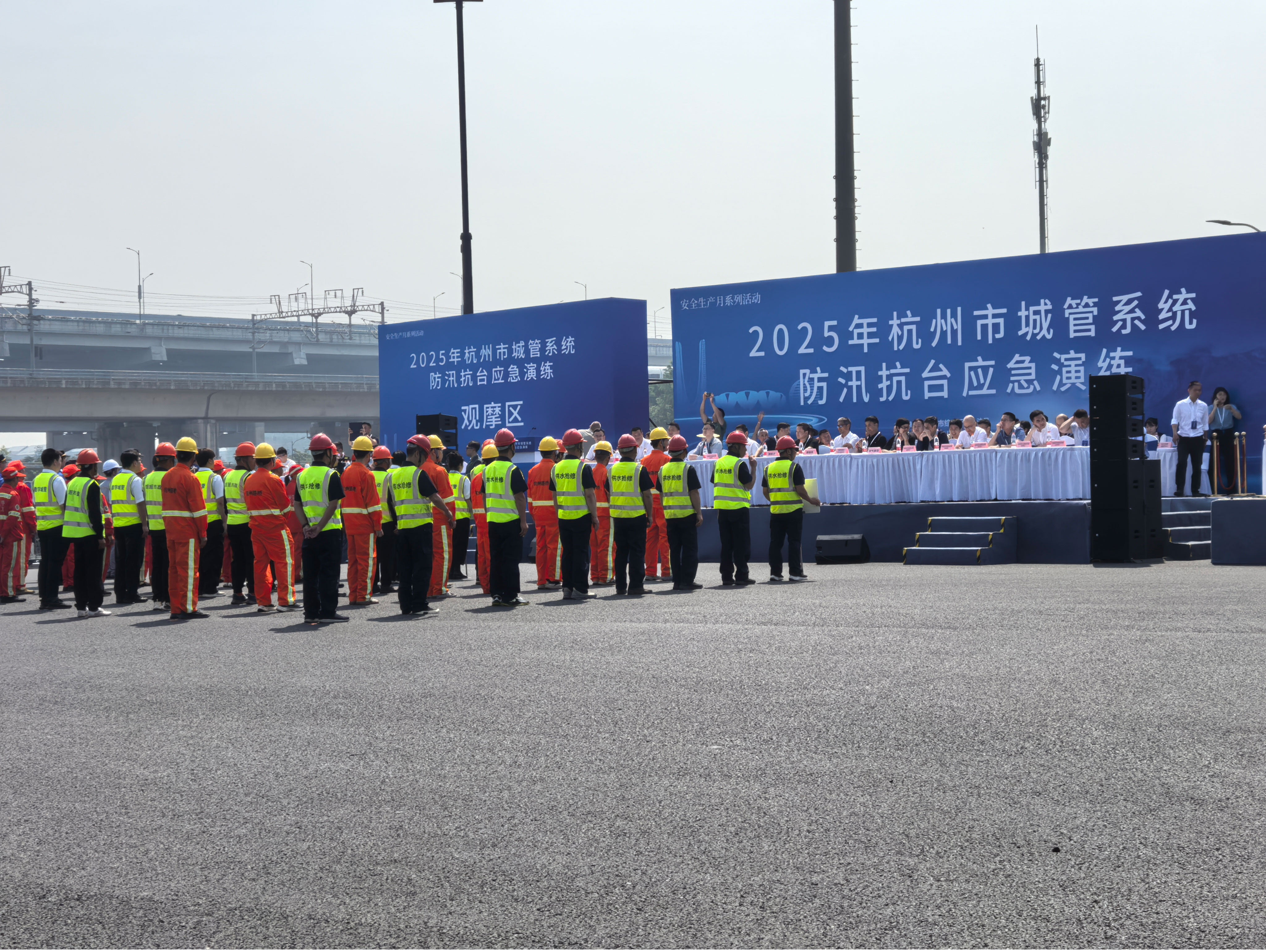
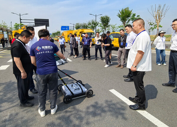
On the morning of 2025年5月26, the Hangzhou Comprehensive Law Enforcement Bureau (Urban Management Bureau), in collaboration with the Xiaoshan District People's Government, organized the "2025 Hangzhou Urban Management System Flood Control and Typhoon Resistance Emergency Drill" at the intersection of Guilan Road and Feihong Road in Xiaoshan District. A total of 120 personnel from 8 emergency response teams across the city's urban management system participated. The drill simulated complex scenarios triggered by a typhoon landing, including ruptured urban water supply pipes, water accumulation in underpass tunnels, and streetlight facility failures, comprehensively testing emergency coordination and response capabilities. Wuhan Shilong Technology Co., Ltd. was invited to showcase two core detection devices. Their on-site demonstrations of underground pipeline and void detection proved highly effective, attracting attention from leaders of the Hangzhou Urban Management Bureau and its branches for discussions, becoming a technological highlight of the drill.
Multi-Hazard Simulation Drills to Fortify Urban Flood Defense Lines
This drill aims to achieve "full-process, full-element, and full-combat readiness," establishing three typical scenarios to test the emergency response system:
Water main break response:Emergency repair teams use smart leak detectors to quickly pinpoint leaks, replace damaged pipes within 20 minutes, and deploy temporary water supply vehicles to ensure residents' water access—demonstrating efficient response through "precise location + rapid repair."
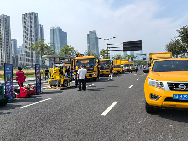
Underpass Waterlogging Drainage:The municipal emergency response team deployed the "Water Tank" de-watering robot and high-capacity pump trucks to clear 50 cm of standing water within 30 minutes. Working in tandem with traffic control units to restore road access, this operation validated the coordinated tactics of robotic operations combined with mechanized joint deployment.
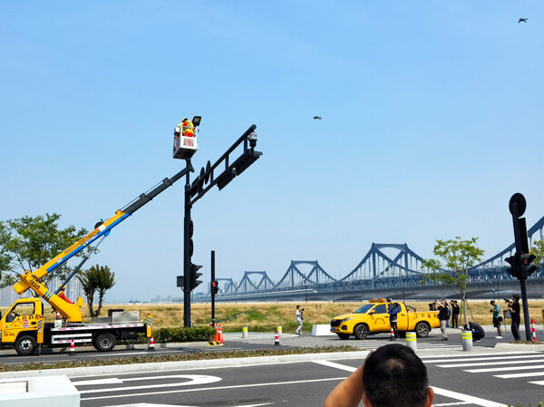
High-Mast Light Emergency Repair:Precisely align the aerial work platform with the suspended lamp head, enforce a four-level safety lockdown throughout the process, and replace the light fixture in 15 minutes to ensure stable nighttime lighting operations, demonstrating standardized and safe aerial work practices.
This drill marks the first end-to-end execution of the full lifecycle: pre-flood hazard inspection, in-flood emergency response, and post-flood review and rectification. It focuses on validating the "four forecasts" mechanism—forecasting, warning, simulation, and planning—while simultaneously testing the operational effectiveness of new equipment in extreme scenarios.
Shilong Technology Unveils Dual Devices; Leaders Address Media Concerns on Tech Applications
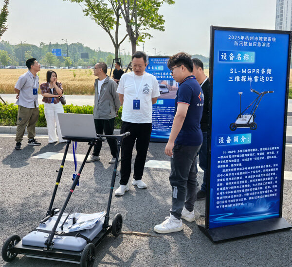
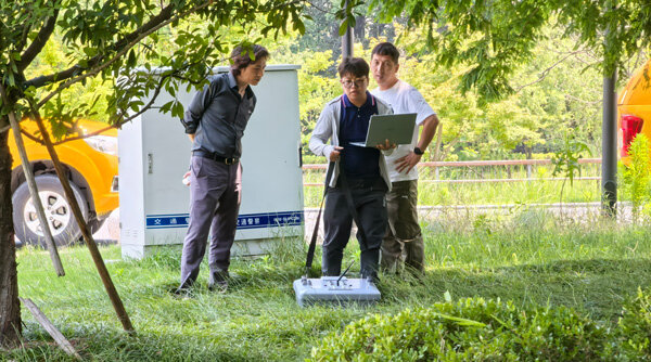
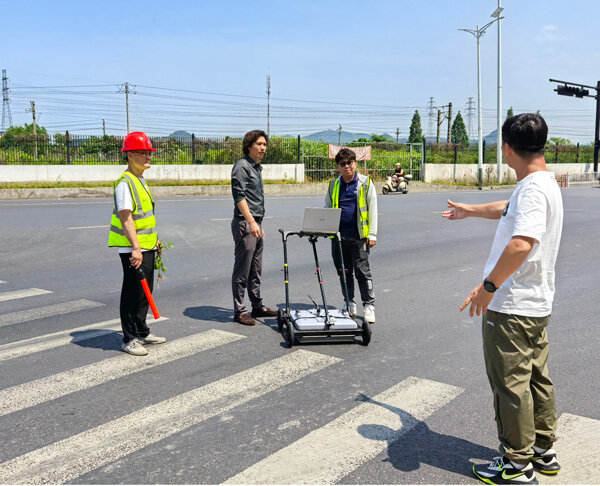
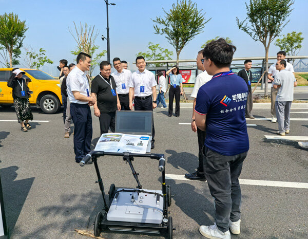
At the equipment demonstration zone, Wuhan Shilong Technology's SL-VGPR vehicle-mounted 3D Ground Penetrating Radar System (Geological Hazard Detection Vehicle) and the SL-MGPR multi-frequency 3D GPR drew significant attention from leaders at all levels of the Hangzhou Urban Management Bureau. Media representatives gathered closely as our team provided detailed explanations of the systems' capabilities and applications. Live demonstrations effectively showcased the precise detection of underground utilities and voids.
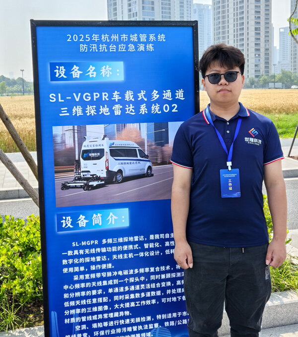
SL-VGPR Onboard Multi-Channel 3D Ground-Penetrating Radar System:This system is a large-scale array radar developed by Wuhan Shilong Technology, based on wideband narrow-pulse electromagnetic wave technology. It integrates ranging systems, BeiDou or GPS positioning, and surveillance camera systems for multi-source data acquisition. The system performs synchronized array scanning at multiple points to capture underground anomalies and features with maximum coverage, enabling precise coordinate localization. It achieves comprehensive ground-to-underground surveying (several meters deep) in a "carpet-style" sweep. With a top speed of 120 km/h, it significantly enhances the quality and efficiency of detecting and identifying subsurface hazards. Ideal for municipal utility surveys, urban roads, highways, railways, bridges, tunnels, airport runways, and other infrastructure requiring hazard and defect detection. Its "mobile vehicle + 3D imaging" mode provides a fast-coverage, high-precision modeling solution for pre-flood road safety inspections.
SL-MGPR Multi-Frequency 3D Ground Penetrating Radar:Using broadband narrow-pulse electromagnetic wave multi-frequency composite technology, this system integrates antennas with different center frequencies into a single probe to balance detection depth and resolution. It simultaneously acquires multi-channel data and processes it into high-resolution 3D images, significantly improving efficiency. In practical applications, it penetrates thick concrete layers to clearly reveal underground void contours and pipeline distributions. The device supports depth detection from 0 to 10 meters. With 200MHz-2GHz multi-band antenna combinations, it achieves millimeter-level resolution and intelligent data interpretation, effectively addressing challenges in assessing ground collapse risks during flood seasons by mapping underground pipeline networks and identifying waterlogging-prone areas.
These two devices precisely address the urban flood control need for "prevention before occurrence," especially in underground space safety monitoring. They provide critical technical support for municipal authorities to identify pipeline hazards and prevent secondary disasters. Municipal departments should accelerate the routine deployment of these robust, essential tools across urban infrastructure inspection systems.
Empowering Flood Control with Technology: A New Chapter of Government-Enterprise Collaboration
According to the Hangzhou Flood and Drought Control Headquarters, Hangzhou is affected by typhoons an average of 3 to 4 times annually. This highlights risks such as underground pipeline leaks and road sinkholes during the flood season. Shilong Technology's "rapid detection, intelligent analysis, and data sharing" capabilities align perfectly with Hangzhou's Smart City Management initiative, which emphasizes empowering safety through technology.
The company is exploring the establishment of a regular inspection mechanism for major urban roads. Plans include deploying vehicle-mounted ground-penetrating radar routes in key areas such as underpasses and old residential communities, with real-time data synchronized to the emergency command center via a cloud platform to build an integrated "air-space-ground" monitoring network. Additionally, the company has launched the development of a digital twin system for urban flood control and geological safety. In the future, this system will use historical data modeling to predict high-risk disaster zones, shifting flood control efforts from "reactive response" to "proactive prevention."
The Hangzhou Urban Management Bureau has currently stockpiled over 1200 sets of flood control equipment, completed dredging and clearing of 7600 kilometers of rainwater pipe networks, and remediated 24 flood-prone areas. With the integration of advanced technologies from companies such as Shilong Technology, Hangzhou is accelerating the construction of an integrated flood safety network combining human, physical, and technical defenses to establish a robust technological barrier ahead of the main flood season starting on 6 15.
This drill not only tested the city's emergency response system in real-world conditions but also marked a deep implementation of the new flood control model featuring government-enterprise collaboration and technology deployment. With the integrated use of 5G, IoT, and smart detection technologies, urban flood control is shifting from "experience-driven" to "data-driven," providing scalable technological solutions for ensuring the safe operation of megacities.